The Assignment
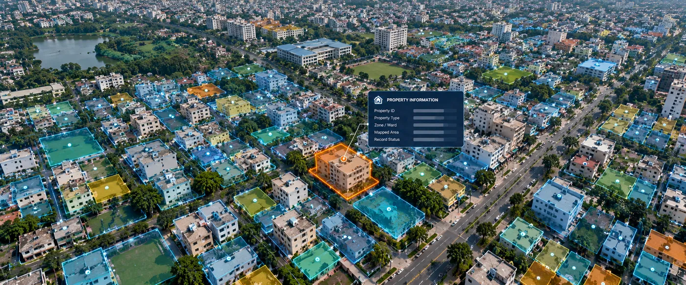
Urban local bodies and government agencies require accurate property information to support administration, planning, service delivery and revenue-related processes. When property records, maps and associated information are maintained across disconnected systems, obtaining a reliable spatial view of properties becomes difficult.
CS TECH Ai's enterprise geospatial capabilities support the creation of GIS-enabled property-information environments that bring property records and location-based information together within a common spatial framework.
The objective is to transform conventional property information into a structured, map-based information environment that can support government workflows, analysis and decision-making.
Our Approach
CS TECH Ai combines property information with GIS mapping and enterprise technology to establish a centralized spatial information environment.
The solution framework includes:
- Property and spatial-data integration
- GIS-based property mapping
- Linking property information with geographic location
- Creation of structured property-information databases
- Integration of spatial and non-spatial information
- WebGIS-based access to property information
- Search, visualization and analysis of mapped properties
- Enterprise workflows for information access and management
- Analytical dashboards and reporting
- Support for government decision-making
This creates a common spatial reference through which property information can be viewed, analysed and used across administrative workflows.
From Property Records to Spatial Intelligence
The overall workflow can be represented as:
Property Information → GIS Mapping → Spatial & Attribute Data Integration → Enterprise GIS / WebGIS → Analysis & Reporting → Government Decision Support
Rather than treating a property as simply a database record, GIS connects the information to its actual geographic location, allowing individual properties to be understood in relation to surrounding land, infrastructure and administrative areas.
CS TECH Ai's broader Digital Enterprise capability supports next-generation WebGIS solutions and the integration and interpretation of spatial, non-spatial and engineering data through enterprise platforms and analytical dashboards.
Property Information at Scale
CS TECH Ai has documented experience working with large property datasets as part of urban infrastructure programmes.
Its urban water-management experience includes programmes across 65+ locations and approximately 10 lakh properties, involving consumer surveys, GIS mapping, utility information and digital management solutions.
This experience demonstrates the ability to organize and work with property-linked spatial information at significant urban scale.
Supporting Property & Revenue Workflows
A GIS-enabled property-information environment can provide a spatial foundation for functions such as:
- Property identification and mapping
- Property-information management
- Linking records with mapped properties
- Spatial search and visualization
- Administrative-area analysis
- Monitoring and reporting
- Identification of geographic patterns
- Government planning and decision support
By bringing spatial and non-spatial information together, the platform provides government users with a more connected view of property information.
Enterprise Spatial Platform
The property-information environment can form part of a wider enterprise GIS architecture rather than operating as an isolated mapping application.
CS TECH Ai's enterprise capabilities encompass WebGIS platforms, integration of spatial and non-spatial information, analytical dashboards, enterprise resource management and enterprise asset-management environments.
This provides the technology foundation for property information to be accessed and used across multiple government functions and user groups.