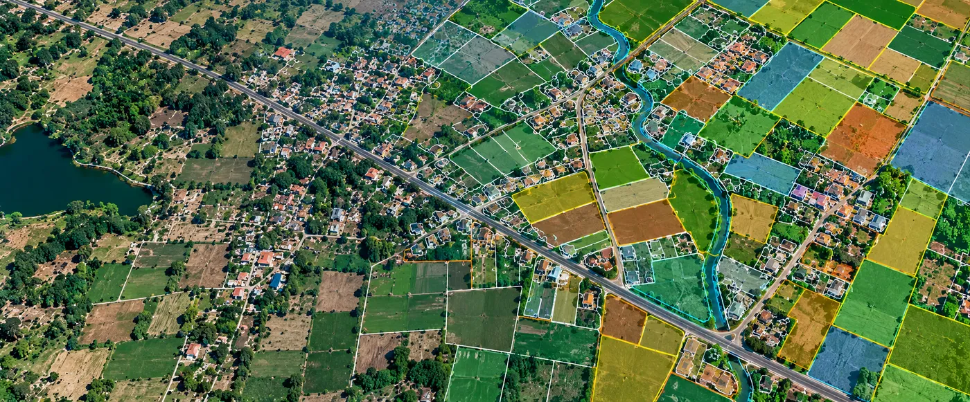
The Assignment
Land-administration and government GIS programmes depend on structured, geographically referenced information that clearly represents land parcels and supports their use within broader information systems.
CS TECH Ai has supported cadastral mapping and land-parcel generation for government and enterprise applications, transforming spatial information into structured GIS datasets that can be used for land-information management, planning and other administrative workflows. Its cadastral and land-data credentials extend across national and international engagements.
Our Approach
CS TECH Ai combines geospatial data processing, digitization and GIS workflows to create structured cadastral and parcel information from available spatial data.
The workflow includes:
- Processing of source geospatial data
- Georeferencing of imagery and spatial information
- Use of Ground Control Points collected through DGPS survey for image correction
- Digitization of relevant spatial features
- Cadastral mapping
- Generation of land parcels
- Creation of structured GIS layers
- Organization of spatial information for subsequent enterprise use
- Preparation of geographically referenced data for government and land-information applications
The process converts source spatial information into digital parcel and cadastral datasets that can be integrated into larger GIS environments.
From Spatial Data to Digital Land Parcels
The overall workflow can be represented as:
Source Spatial Data → Georeferencing & Processing → Digitization → Cadastral Mapping → Land Parcel Generation → GIS Database → Enterprise Use
CS TECH Ai's documented data-processing workflow includes the collection of Ground Control Points through DGPS survey and correction of acquired imagery using these points to bring the information into the required geographic reference framework.
Cadastral & Parcel Intelligence
The resulting spatial information provides a structured representation of land units that can form part of broader land-information environments.
The capability supports:
- Digital cadastral mapping
- Land-parcel generation
- GIS-based land information
- Spatial-data organization
- Government land-administration workflows
- Enterprise GIS applications
- Integration of parcel information with other spatial datasets
CS TECH Ai has established cadastral mapping and land-parcel generation credentials for national and international clients, with its geospatial information supporting state governments and organizations across India, the USA, UK, Europe and the Middle East.
Supporting Enterprise Use
The value of cadastral information extends beyond creation of the parcel map itself.
Once digitized and structured within GIS, land-parcel information can become part of wider spatial-information environments, allowing it to be combined with other geographic datasets and deployed for government and enterprise applications.
This reflects CS TECH Ai's broader approach of moving from raw spatial data through processing and digitization to information that can be used within enterprise geospatial systems.