Geospatial Support for Smarter, Data-Driven Public Infrastructure
From broadband planning and transport corridor mapping to parcel-level utility data and civic asset modeling – we help public agencies and infrastructure consultants make better, faster decisions.

Who We Serve
State & Local Government Agencies
Departments of Transportation (DOTs)
Public Broadband & BEAD Program Offices
City Planning & Land Records Departments
Infrastructure Design & Planning Consultants
What We Offer

Broadband Infrastructure Mapping
Support for NTIA and BEAD-funded programs with address-level fiber planning, underserved area mapping, and validation of broadband footprints.

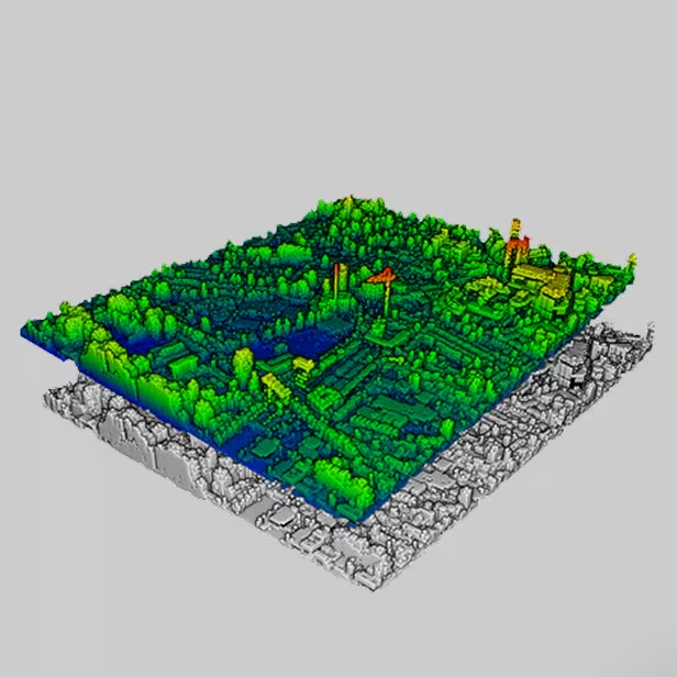
Transport Corridor & ROW Modeling
Aerial and mobile LiDAR mapping of roadways, utility corridors, and rights-of-way to support engineering, upgrades, and capital projects.

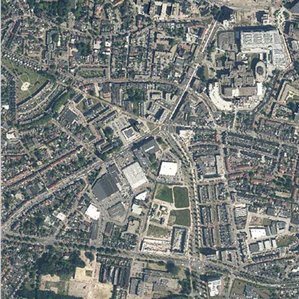
Parcel & Land Records Mapping
Digital parcel creation and data conflation for land ownership, tax mapping, and urban planning.

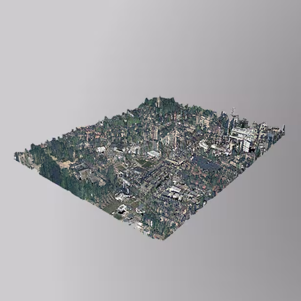
Civic Asset Documentation
Capture and modeling of public buildings, schools, intersections, and infrastructure for digital twin development and smart city planning.

Environmental & Planning Support
Spatial data products to support zoning analysis, impact assessments, and environmental review workflows.
Broadband Infrastructure Mapping
Support for NTIA and BEAD-funded programs with address-level fiber planning, underserved area mapping, and validation of broadband footprints.
Transport Corridor & ROW Modeling
Aerial and mobile LiDAR mapping of roadways, utility corridors, and rights-of-way to support engineering, upgrades, and capital projects.
Parcel & Land Records Mapping
Digital parcel creation and data conflation for land ownership, tax mapping, and urban planning.
Civic Asset Documentation
Capture and modeling of public buildings, schools, intersections, and infrastructure for digital twin development and smart city planning.
Environmental & Planning Support
Spatial data products to support zoning analysis, impact assessments, and environmental review workflows.
How We Deliver
Step 1: Capture
Aerial, mobile, and field data collection using drones, LiDAR, and advanced mapping sensors.
Step 2: Model & Analyze
Transform raw data into spatial layers, corridor models, parcel datasets, and digital twins.
Step 3: Deliver
WebGIS-ready datasets, GIS layers, maps, and dashboards tailored to planning and agency systems.