Geospatial Support for Smarter, Faster Network Rollouts
From tower audits and fiber corridor mapping to permit-ready design data and digital twins – we help telecom operators, tower companies, and fiber providers reduce delays, improve visibility, and scale deployments.

Who We Serve
Mobile Network Operators (e.g., Verizon, Dish Wireless, T-Mobile)
Tower Companies (e.g., Crown Castle, American Tower)
Fiber ISPs and Broadband Providers (e.g., Zayo, Brightspeed)
Engineering & Turf Vendors (e.g., Mastec, Tilson)
What We Offer

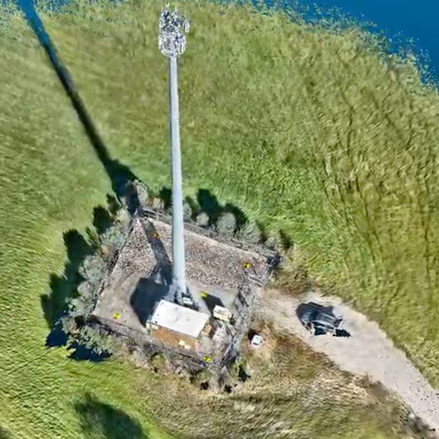
Tower & Site Capture
High-resolution LiDAR, drone imagery, and 360° mobile mapping for rooftop, tower, and shelter documentation.
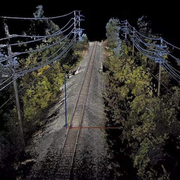
Digital Twins & 3D Modeling
Highly accurate 3D models of towers, fiber nodes, shelters, and equipment mounts for design validation and asset management.

Fiber Network Planning Support
Pole audits, address verification, HLD/LLD-ready GIS data, and make-ready engineering support.

GIS & Asset Mapping
Parcel, corridor, and utility asset mapping with spatial data layers for permitting, compliance, and design integration.

Make-Ready & NOC Documentation
Support for pole load analysis, structural validation, and network design documentation for deployment handoffs.
Tower & Site Capture
High-resolution LiDAR, drone imagery, and 360° mobile mapping for rooftop, tower, and shelter documentation.
Digital Twins & 3D Modeling
Highly accurate 3D models of towers, fiber nodes, shelters, and equipment mounts for design validation and asset management.
Fiber Network Planning Support
Pole audits, address verification, HLD/LLD-ready GIS data, and make-ready engineering support.
GIS & Asset Mapping
Parcel, corridor, and utility asset mapping with spatial data layers for permitting, compliance, and design integration.
Make-Ready & NOC Documentation
Support for pole load analysis, structural validation, and network design documentation for deployment handoffs.
How We Deliver
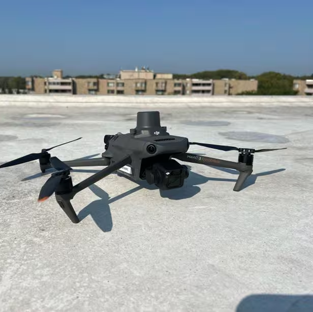
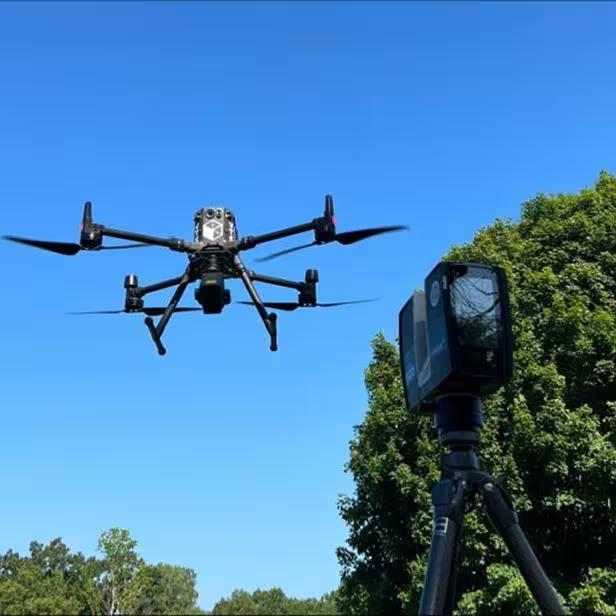
Step 1: Capture
Using drones, LiDAR, and mobile mapping units to collect asset data quickly and safely.
Step 2: Process & Model
Converting raw inputs into actionable outputs – 3D models, digital twins, spatial datasets, and CAD/GIS packages.
Step 3: Deliver
Clean, standardized deliverables ready for permitting, planning, and construction.